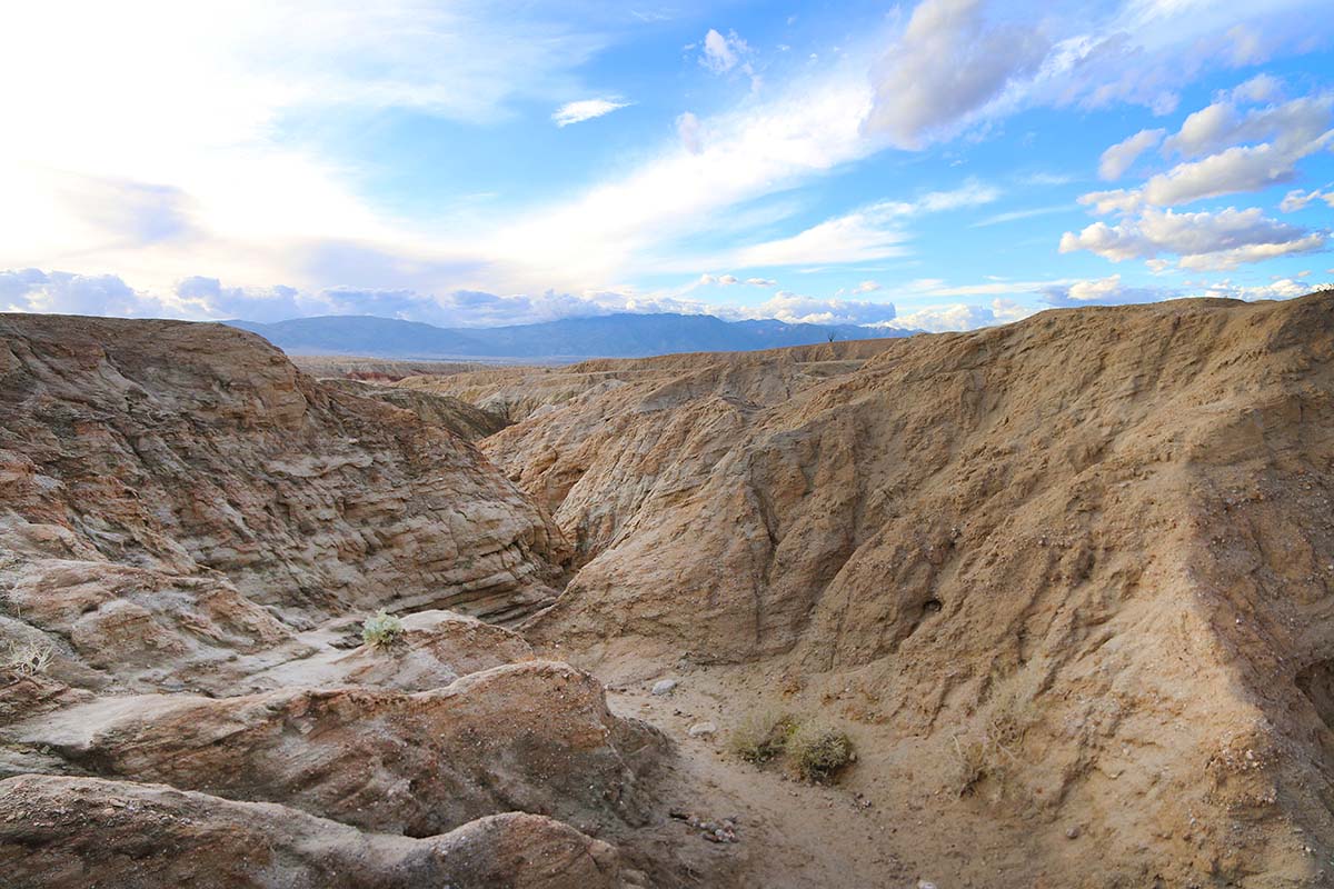


Calcite Mine Slot Canyon
0 Reviews
Hello everyone! This is a friendly reminder that any of these fun places we may visit, we are a guest at. Please treat both businesses and trails with the utmost respect. We here at Hidden San Diego follow the 'Leave no Trace' mantra, meaning whatever you bring with you comes back with you. If you see trash on a trail, please do your part to help remove it. Remember, we are not picking up trash from another person but instead cleaning up for Mother Nature. Happy adventures!
Calcite Rd. Borrego Springs,
CA 92004
(The contributor of this article does not want to give direct directions to the slot canyons but just know they’re nearby)
Dog-Friendly: No Kid-Friendly: Older kids, yes
Miles: 3.7 out and back Level of Difficult: Easy to challenging depending on what you choose to do out here
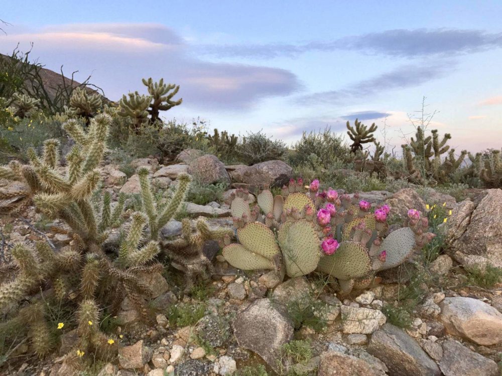
**Make sure to check out our list of Hidden Gems in Anza Borrego State Park for the ultimate day trip!**
About the Calcite Mine Slot Canyon
Article and photos by Shane Gundelfinger:
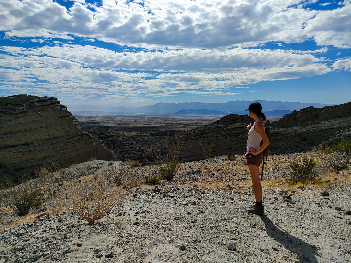
I love slot canyons. The slittier the better. The Anza Borrego desert is full of them, but they usually require high clearance and four wheel/all-wheel drive to safely access. My car has unfortunately learned its lesson from vast ventures to not trespass these conditions.
So after a healthy session of scrutinizing Google Maps’ satellite view, I was highly intrigued to find what appeared to be a slot canyon easily accessible directly from the highway. And dare I say it did not disappoint.
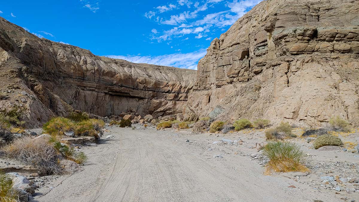
 As the desert would have it, those with vehicles built for adventure could certainly blaze further into this territory, shortening the initial hike in. Without such a vehicle, we were perfectly content to leave my car safely on a dirt plateau and hike down into the natural wash on foot.
We missed the designated turnout with the official sign, since said sign only faces West-bound traffic for some reason, but just as well this turnout was obscured by a rather intimidating dirt hump that I would have preferred not to push my low-clearance vehicle over.
The initial drop down presented us with a four-way intersection between a wide wash and an uphill truck trail. My downloaded offline maps told us to press forward so we ascended the truck trail, wondering what may have lay beyond the wash. Spoiler alert, we found out later and it was awesome.
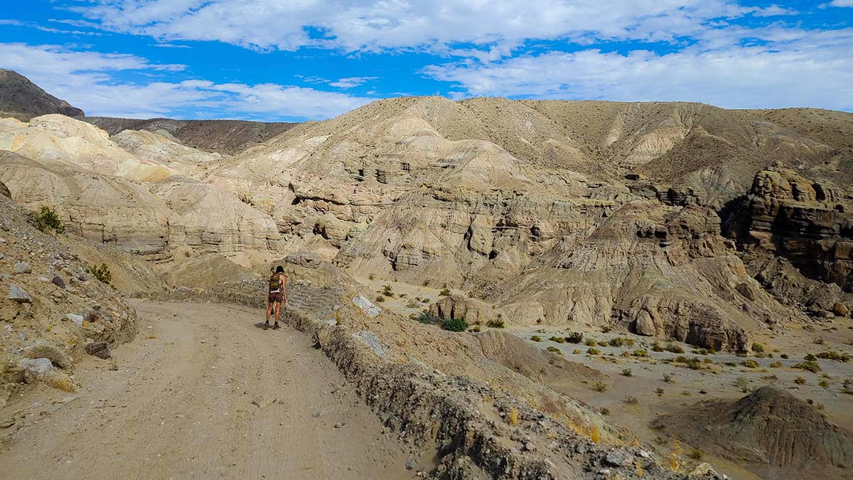
We followed the trail for about .7 miles until we found a clear intersection with a dirt path that descended towards the right into another wash. This checked out with my offline maps so we bailed from the truck trail ASAP, and the hike immediately got more interesting as we headed Northwest along the wash.
While you’re in the area, make sure to visit Galleta Meadows nearby!
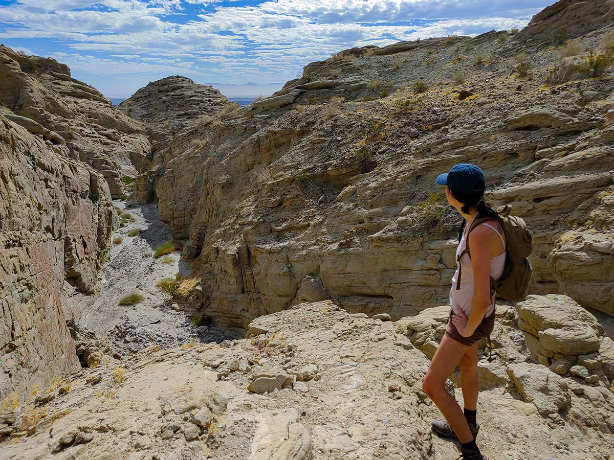
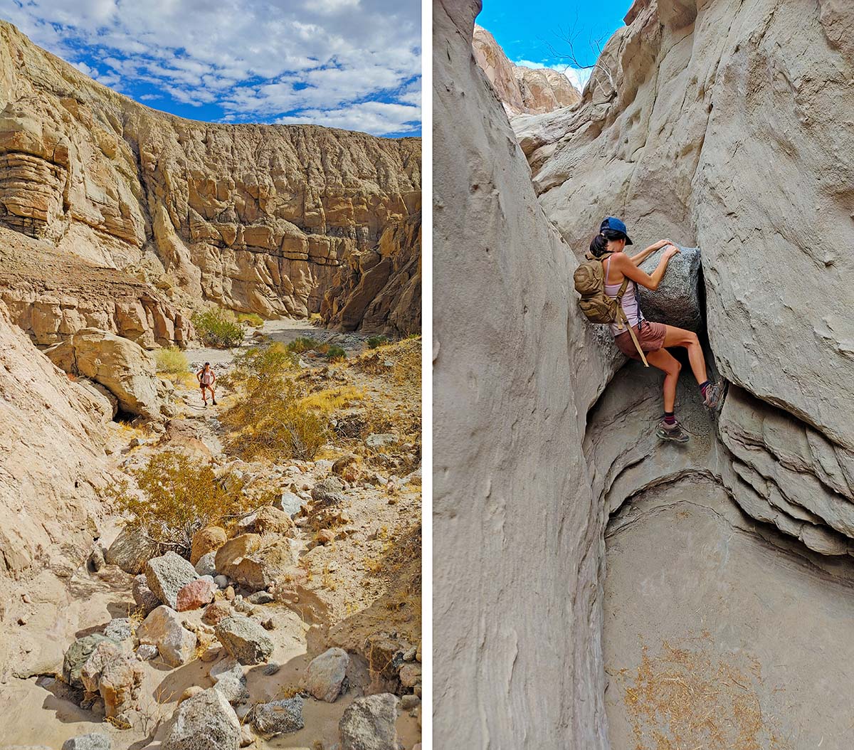
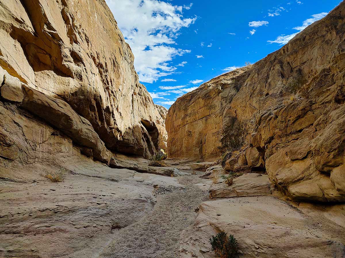
Especially once we passed a sign that forbid any vehicles beyond that point. What started off as a decently wide canyon gradually narrowed into a satisfyingly slitty slot. Occasionally some rock scrambling and shimmying was necessary to press forward as the wash followed a subtle incline. Bonus points in my adventure book.
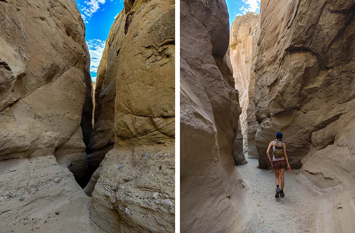
It should be noted immediately that once you are in the slots there are multiple intersection points, most of which are obscured by an incline through the slots. I HIGHLY recommend downloading offline maps on a device with reliable GPS if you are going to explore these slots, as it is incredibly easy to get lost without it. Especially since some require greater degrees of scrambling than others. I used Alltrails Pro, but Google Maps and other apps provide free alternatives.
 We eventually intersected with the truck trail once again but chose to press forward through another rewardingly narrow slot section. This is where the map really came in handy. Following the canyon eventually lead to a rather large boulder and incline.
While it looked manageable with good scrambling skills, it looked too difficult to actually be a part of the listed trail. Turns out I was right, but I question whether the correct path was actually easier, which I documented in my adventure video.
While I never would have guessed by looking, the trail path instructed us to scale our way up the side of the cliff up and over the canyon walls. The top was not encouraging either, with no shoeprints to suggest others had gone this way.
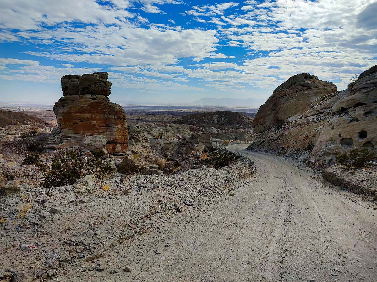
Actually we hadn’t seen anyone this entire time. But we did find calcite! Did I mention the truck trail leads to a historic calcite mine? Probably not because there is no mine shaft or cave that I would hope from such a proposition, so I’m sparing you the disappointment.
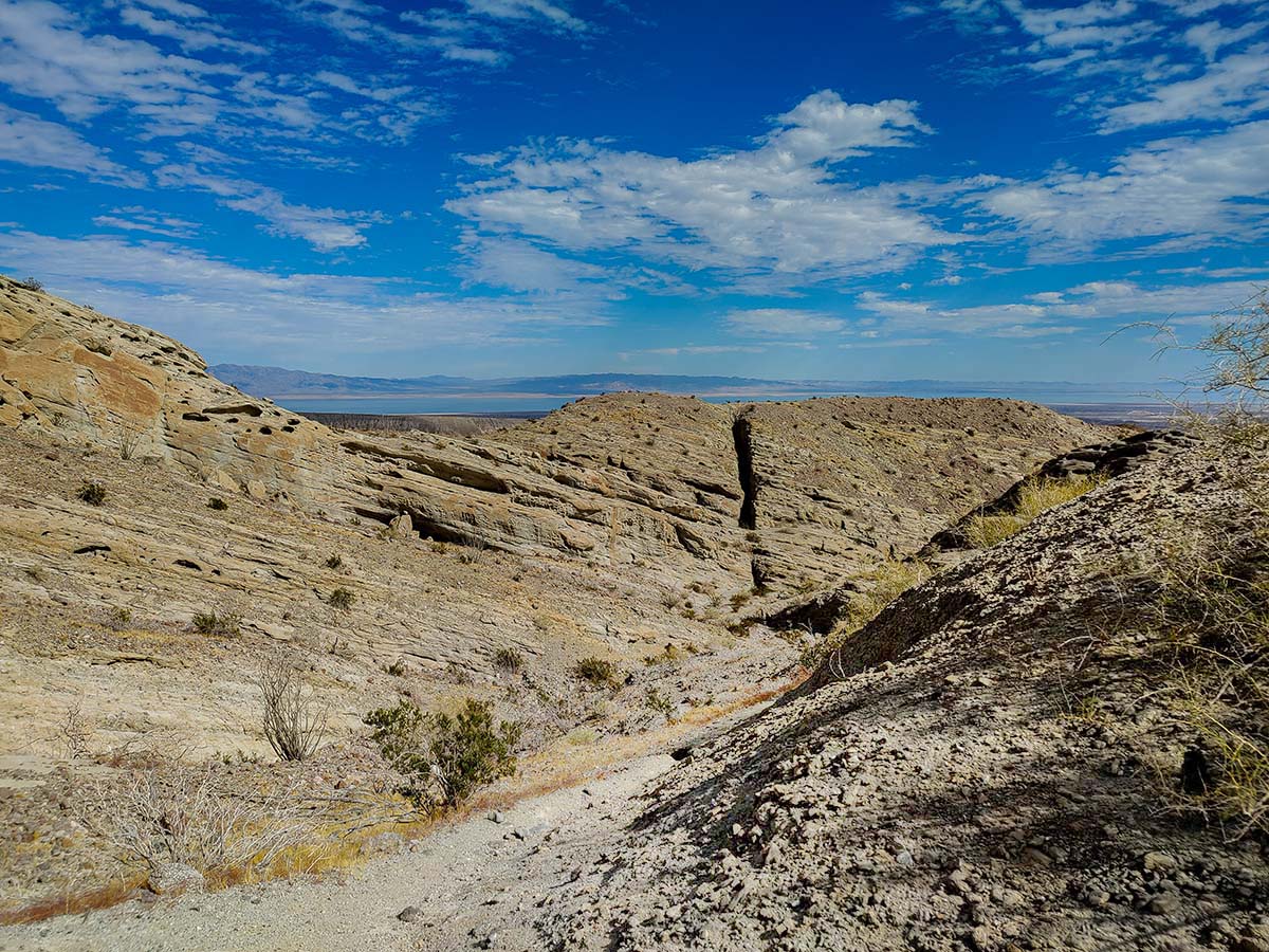
Nonetheless, we followed my map through its crazy shenanigans and low and behold we found ourselves right above the truck trail and a “Calcite Mine” sign. Hazzah the map worked!! From here we were afforded gorgeous panoramic views of the lower desert terrain, and even glimpses of the Salton Sea to the East.
Now I won’t be the first to tell you that I detest out-and-backs when they can be avoided, so with our reinforced faith in the map we set out to find a completely different slot canyon to take us all the way back. The map showed a trail branching off from the truck trail, but our eyes didn’t agree. So we scaled up an edge and dropped down some sketchy stuff with the faint promise of a narrow footpath in the distance beyond the edge.
Well sure enough that worked too cause once we reached the path shoeprints appeared in the sand. And I don’t mean from our own shoes, which could be fairly concluded from such semantics. I mean fresh, wholesome, people-have-gone-this-way-before-so-let’s-stop-worrying-that-we’re-getting-ourselves-too-deep-here shoeprints. These lead us to a prominent intersection with what was clearly the main trail in this canyon.
 Once on course again in this brand new slot canyon, we discovered multiple forks with mysteries leftover for future return adventures. In the interest of time we played it safe from this point and headed South in a dynamic sequence of narrow and wide slots. Only now did we finally encounter people for the first time.
They were exploring this specific slot canyon to its end and back, with no conception of the complex network and territory we had meandered through to get here. This is when I learned that most people drive into this lower wash and hike to the end of the slot canyon and back.
As fate would have it, this wash lead us right back to the original four way intersection at the very beginning of the hike. Therefore I have concluded that if you do not have offline maps or a strong sense of navigation, the safest route to take is this particular wash.
I will reiterate: If you are going to explore this area without a detailed map and strong sense of navigation, do this: Take the truck road down to the big wash intersection. Go left on the bottom wash. Keep following that WITHOUT meandering. When you eventually feel like stopping, turn around and come back exactly the way you came.
This area is extremely easy to get lost in with a plethora of canyons and offshoots that all look indistinguishable from each other to the untrained eye. Or follow the truck trail until you get to the Calcite “mine”, but in my opinion this hike is not worth it just for that.
Conclusion
I utterly loved this area and found its diverse network of slot canyons to be far more engaging than the narrow slot canyons I have previously explored in other areas of Anza Borrego. The only tradeoff is that the narrowest and deepest portions of the slot canyons are far shorter lived here than in other more prominent slot canyons.
It’s well worth the tradeoff for its easy accessibility from the highway. It’s even MORE worth the tradeoff if you are highly experienced in off trail adventuring and enjoy rock scrambling and map plotting. There are so many more networks to connect. I look forward to returning for a longer session to fully explore the various offshoots and see what secrets they contain.